Which Trees Will Be Cut in Your Neighborhood?
BPCA's own maps show every tree marked for removal across 7 neighborhoods. The reality may be even worse.
These maps are BPCA's own latest "N/WBPCR Project Tree Impacts Map," posted to bpcresiliency.info in May 2026.[1] Each reach shows both the FEIS (May 2025) baseline and the current count after the December 2025 Technical Memorandum. Project-wide, removals rose from 435 (FEIS) to 502 (current map), with the biggest jump along Route 9A in Tribeca (+54 trees).
How to read these maps
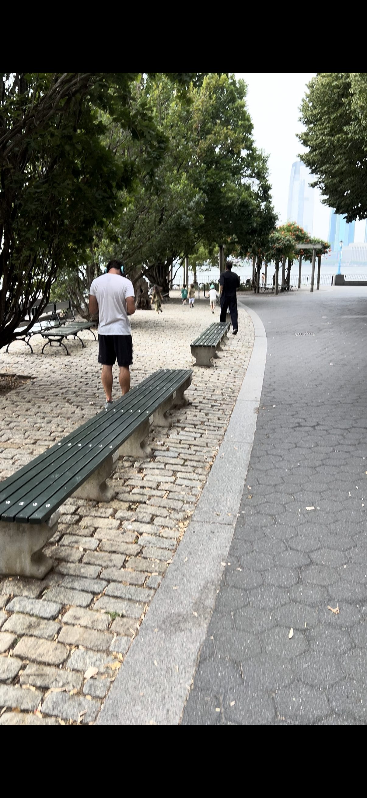
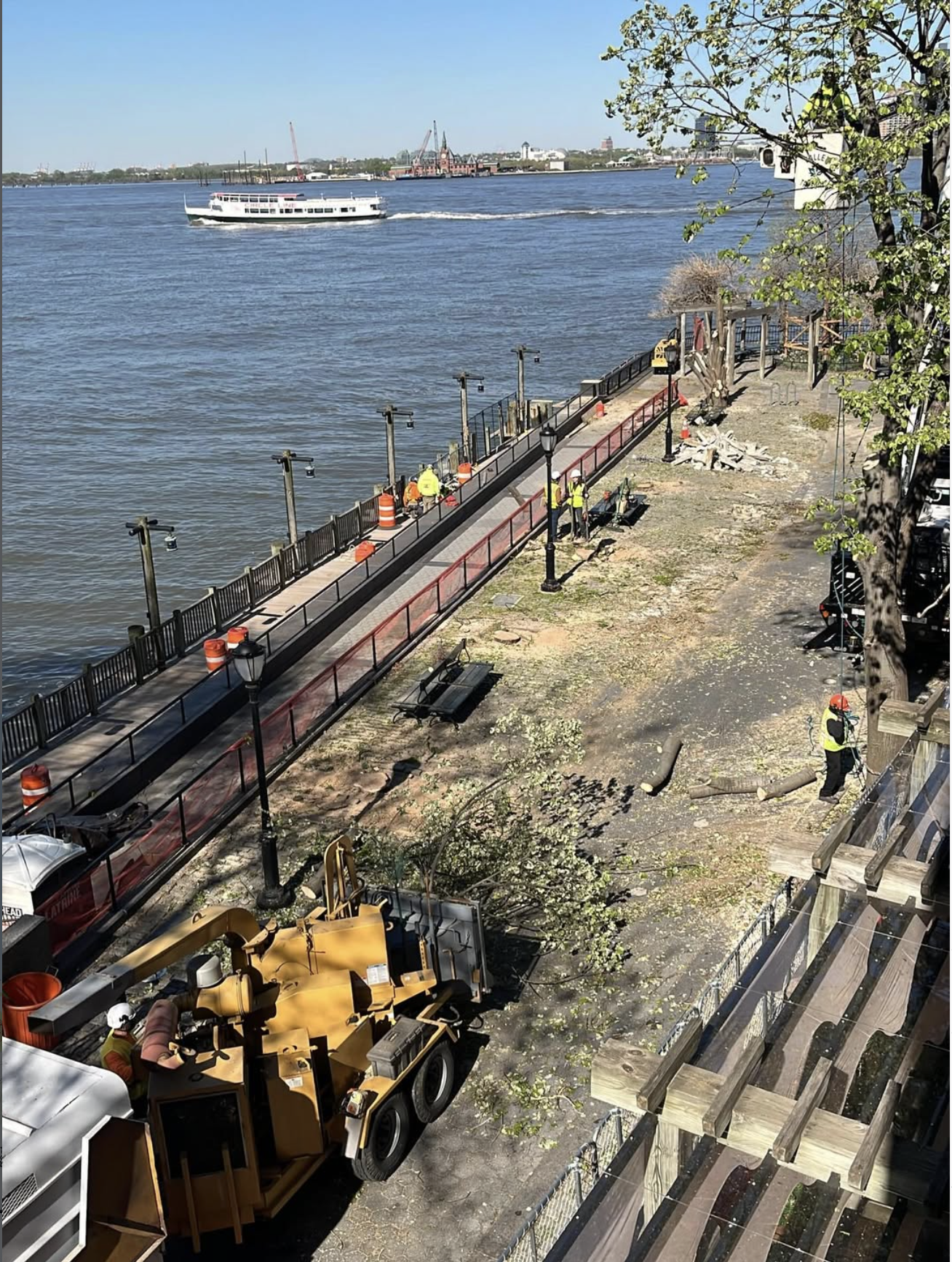
Any tree that is not green — red, brown, or gray — is poised to be removed. In some areas like South Esplanade and Ferry Terminal, the overwhelming majority of trees are marked for removal.
The maps also mark "trees to be transplanted," but only 17 out of 500 trees (less than 4%) are even being considered for transplanting[2] — and the transplant color is so close to the removal color on these maps that it's effectively impossible to distinguish them.
| Neighborhood | FEIS (May 2025) | Current (May 2026) | % of local trees |
|---|---|---|---|
| Route 9A / West St / Tribeca | 65 | 119 | — |
| North Esplanade | 30 | 29 | — |
| N. Neighborhood / Rockefeller Park | 35 | 37 | — |
| Ferry Terminal / Lily Pond | 25 | 26 | ~54% |
| Brookfield Place / North Cove | 120 | 121 | — |
| South Esplanade | 125 | 139 | ~80% |
| South Neighborhood / South Cove | 35 | 31 | — |
| Total | 435 | 502 | ~42% of all trees |
South Neighborhood / South Cove
31 trees marked for removal around South Cove (was 35 in FEIS).
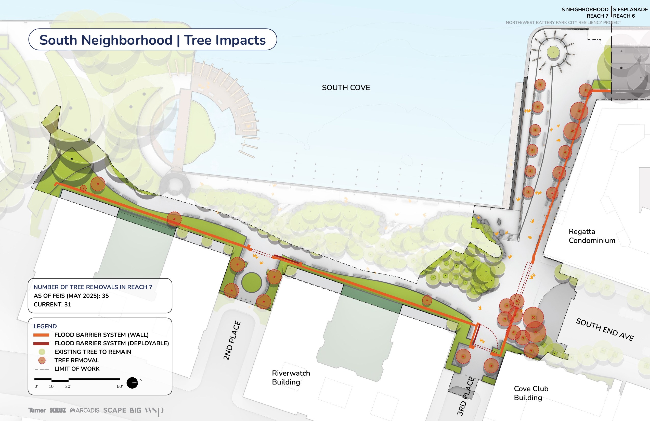
Source: BPCA N/WBPCR Project Tree Impacts Map (May 2026), Reach 7. Click to enlarge.
South Esplanade
139 trees marked for removal (was 125 in FEIS) — ~80% of all trees along the esplanade.
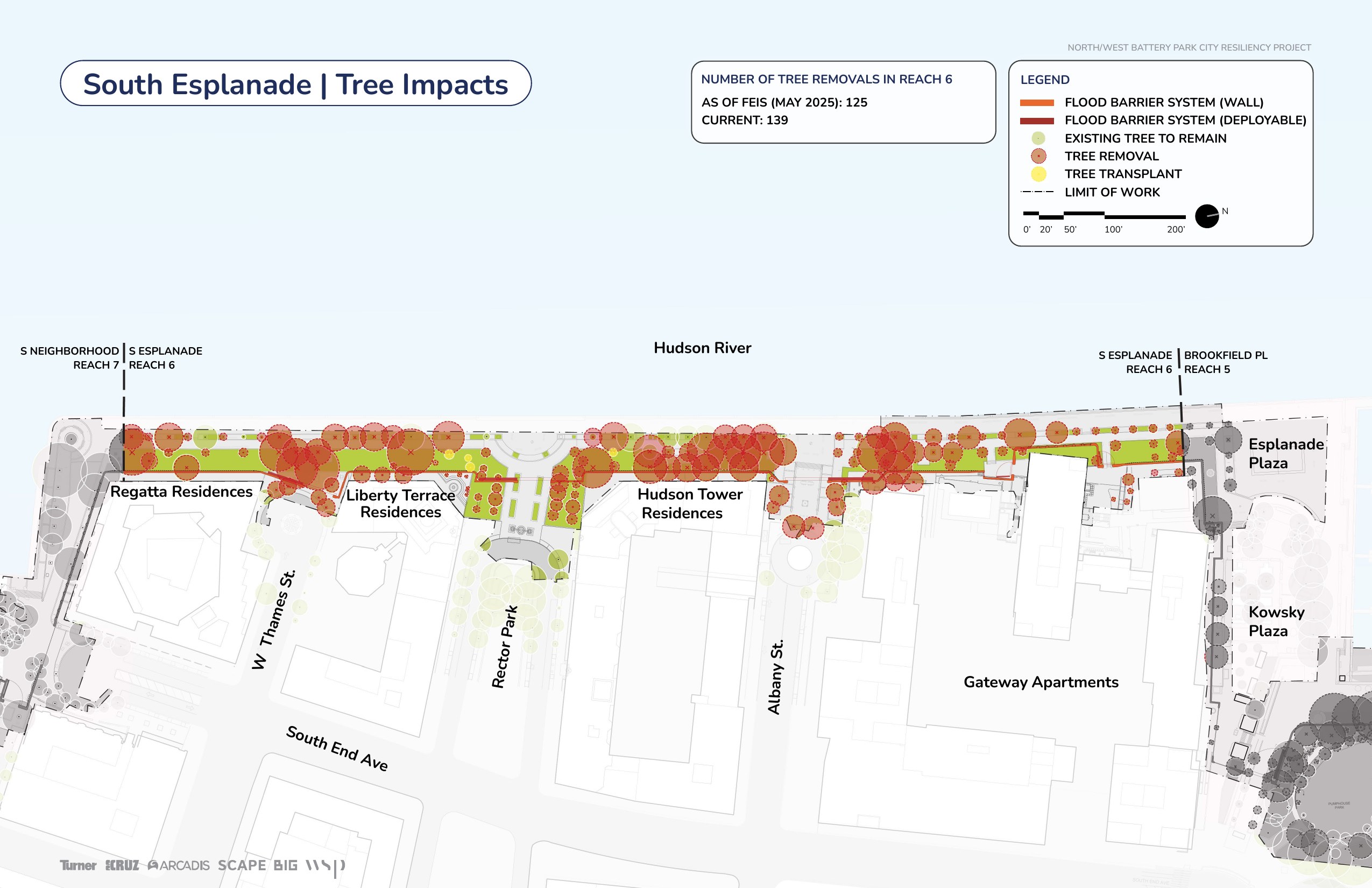
Source: BPCA N/WBPCR Project Tree Impacts Map (May 2026), Reach 6. Click to enlarge.
Brookfield Place / North Cove
121 trees marked for removal in the Brookfield Place area (was 120 in FEIS).
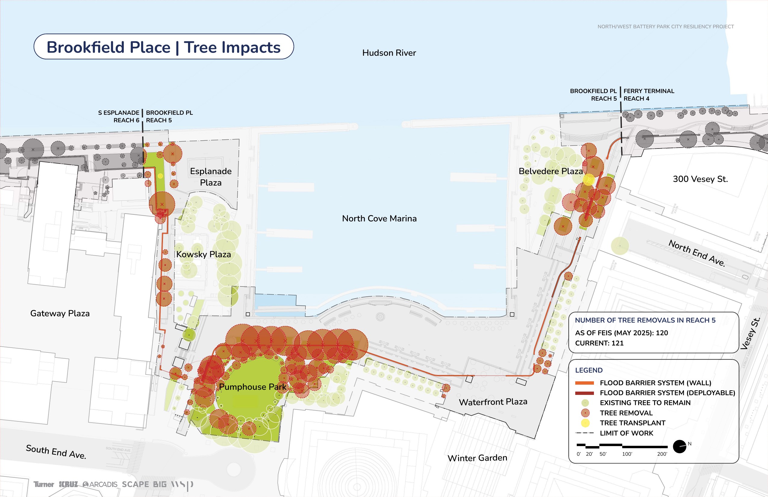
Source: BPCA N/WBPCR Project Tree Impacts Map (May 2026), Reach 5. Click to enlarge.
Ferry Terminal / Lily Pond
26 trees marked for removal — ~54% of all trees in the Ferry Terminal area.
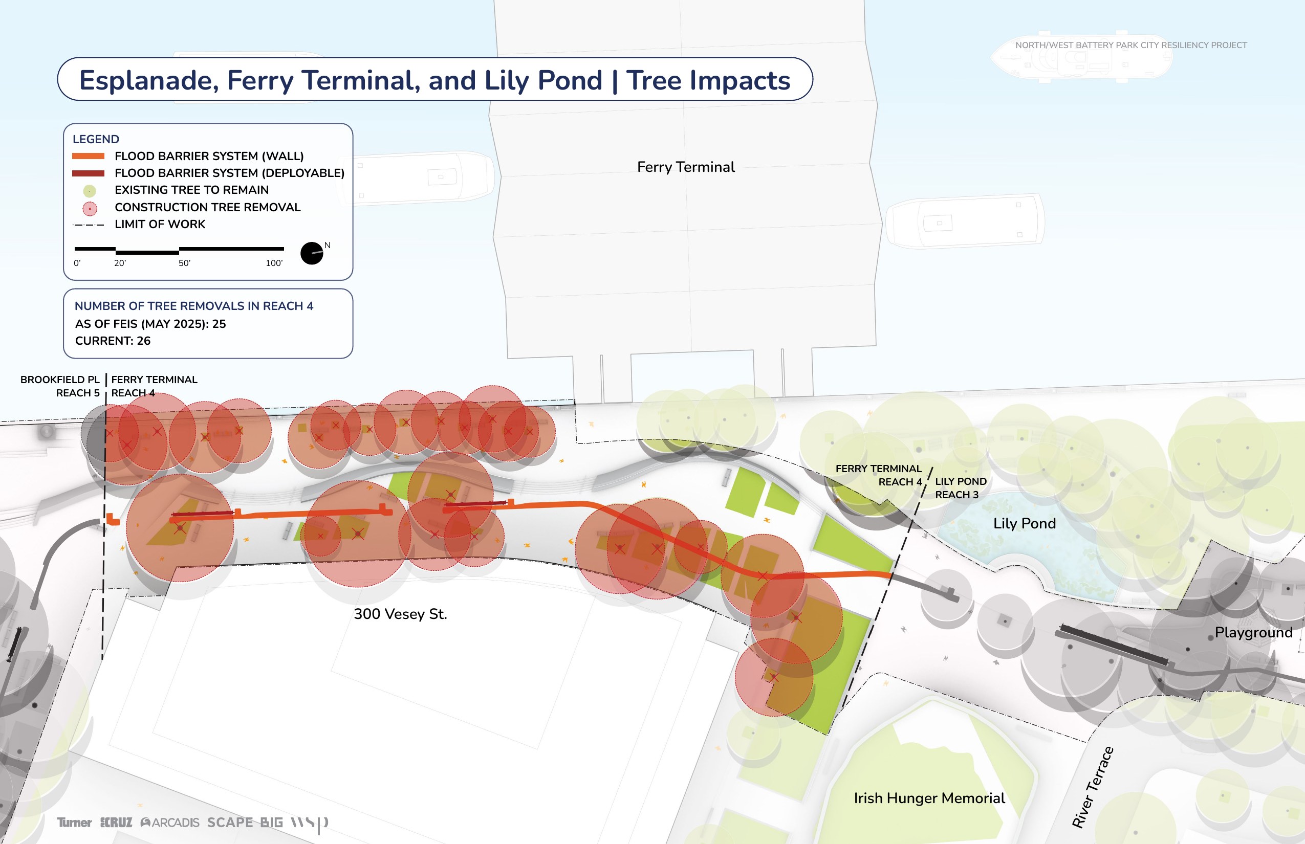
Source: BPCA N/WBPCR Project Tree Impacts Map (May 2026), Reach 4. Click to enlarge.
Route 9A / West St / Tribeca
119 trees marked for removal along the Route 9A corridor (was 65 in FEIS — nearly doubled).
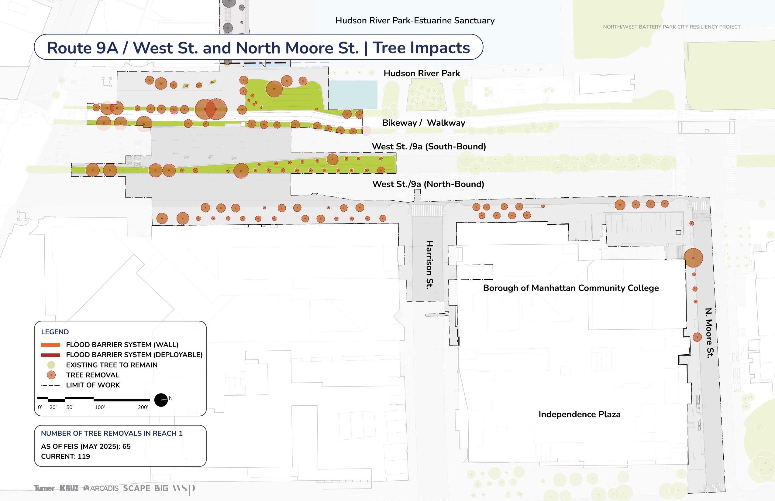
Source: BPCA N/WBPCR Project Tree Impacts Map (May 2026), Reach 1. Click to enlarge.
North Neighborhood / Rockefeller Park
37 trees marked for removal around Rockefeller Park and the ball courts.
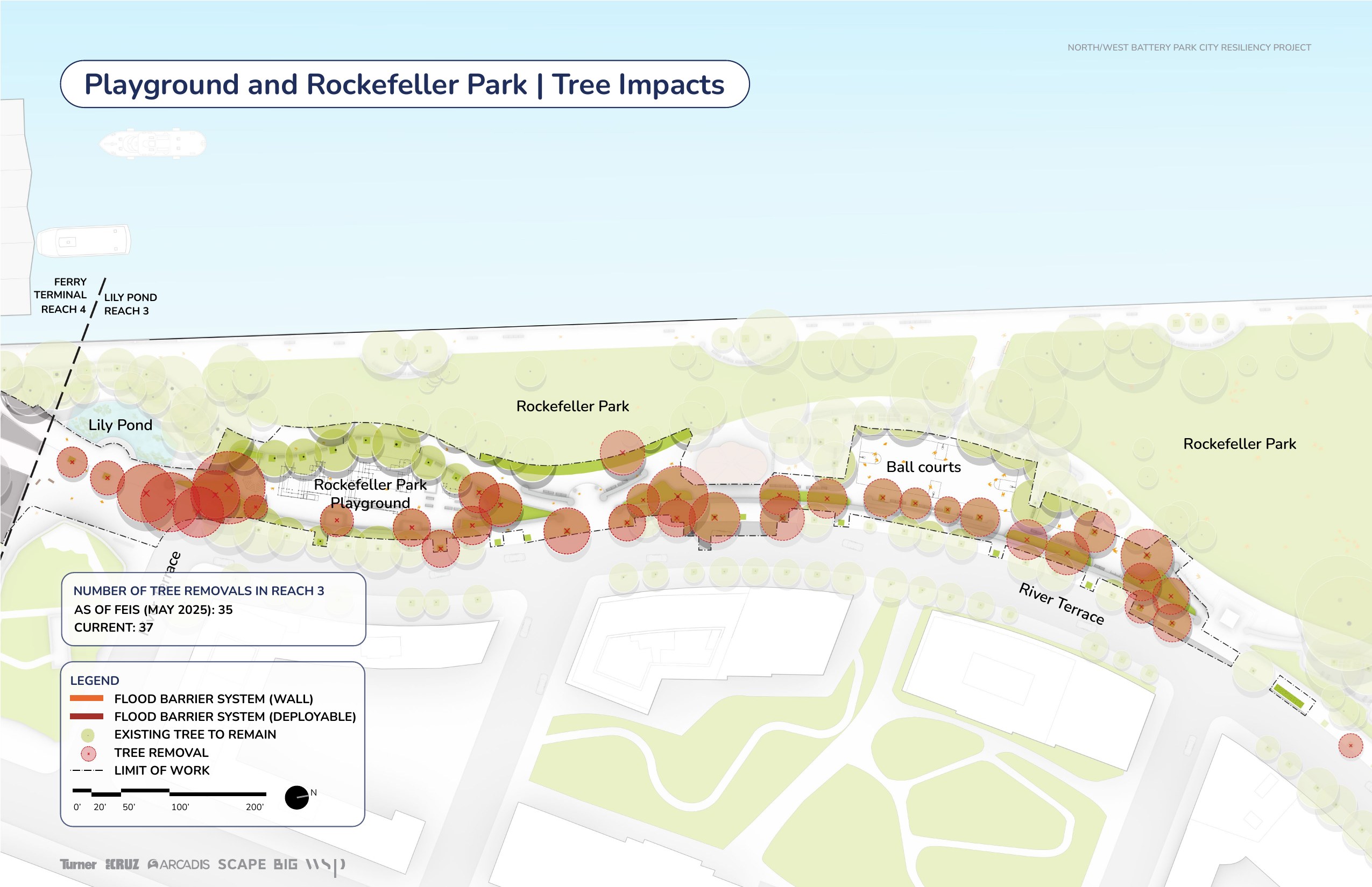
Source: BPCA N/WBPCR Project Tree Impacts Map (May 2026), Reach 3. Click to enlarge.
North Esplanade
29 trees marked for removal along the North Esplanade near Tribeca Pointe and Stuyvesant High School.
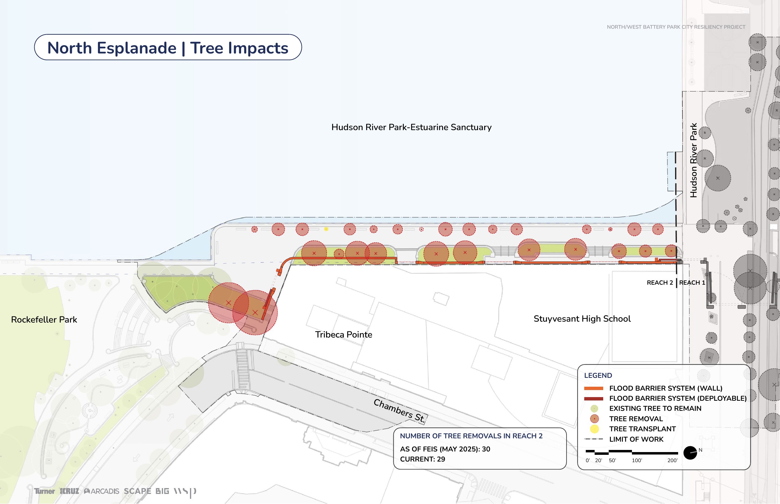
Source: BPCA N/WBPCR Project Tree Impacts Map (May 2026), Reach 2. Click to enlarge.
500 mature trees don't have to be cut. BPCA has never even applied for the federal variance that could save them. Demand a pause.
Take Action →Sources
- BPCA — N/WBPCR Project Tree Impacts Map (May 2026) — updated per-reach tree impact maps with side-by-side FEIS (May 2025) and CURRENT counts; published on bpcresiliency.info /construction-updates
- BPCA Final EIS — Response to Comments (May 2025) — Table 10-1: revised count of 435 trees removed, 450 planted
- BPCA Final EIS — Executive Summary (May 2025) — ES-18: DEIS commitment to explore FEMA variance process struck from Final EIS (visible in strikethrough text)
- BPCA Final EIS — Chapter 3.5 Natural Resources (May 2025) — 1,181 trees inventoried; "no significant adverse impact" determination
- BPCA Post-FEIS Technical Memorandum (December 19, 2025) — Table 3: per-reach tree removal and replacement counts, raising the project total from 435/450 to 500/525